Make your smarter with EarthAI
Your integrated Geospatial AIOps platform for managing data, building capabilities, and delivering insights.
Living Algorithms for a Changing Planet
From climate change to COVID-19, the Earth is changing quickly. Traditional geospatial approaches depend on manual processes that don't scale, resulting in static outputs. With EarthAI, we've re-envisioned geospatial analysis by creating a new spatial data infrastructure to unlock GeoAI. Removing the complexity, keeping outcomes at the center.
Discover, procure, and prepare only the data you need without confusing pricing and lengthy searches
Create scalable geospatial analytics while leveraging talents across your organization
Automate GeoAI workflows and pipelines to productionize insights quickly and accurately
An Integrated GeoAI Ops Platform


Geospatial imagery is being used across industries.
We can help you utilize this growing resource for your organization.
Featured Case Study:
Using EarthAI to analyze COVID-19 Economics
The COVID paradigm has introduced ambiguity for investors in the travel & leisure sector. While retrospective analysis of quarterly financial statements can provide insight into investment opportunities, historical data cannot provide insight into the effects the global pandemic is having on these brands. Using artificial intelligence on satellite imagery and mobility data, Pulse of the Park provides a near-real-time signal of the ground conditions at each park that drives company revenue. Our team uses high-frequency, multi-source intelligence derived from satellite, mobile, and web data sources for results guaranteed through our "human-in-the-loop" AI validation workflows. Get accurate, timely intelligence for the location of your choice sent directly to your email so you can focus on insights and not managing data.
* Based on parking lot density relative to seasonal average
Trusted by Global Influencers
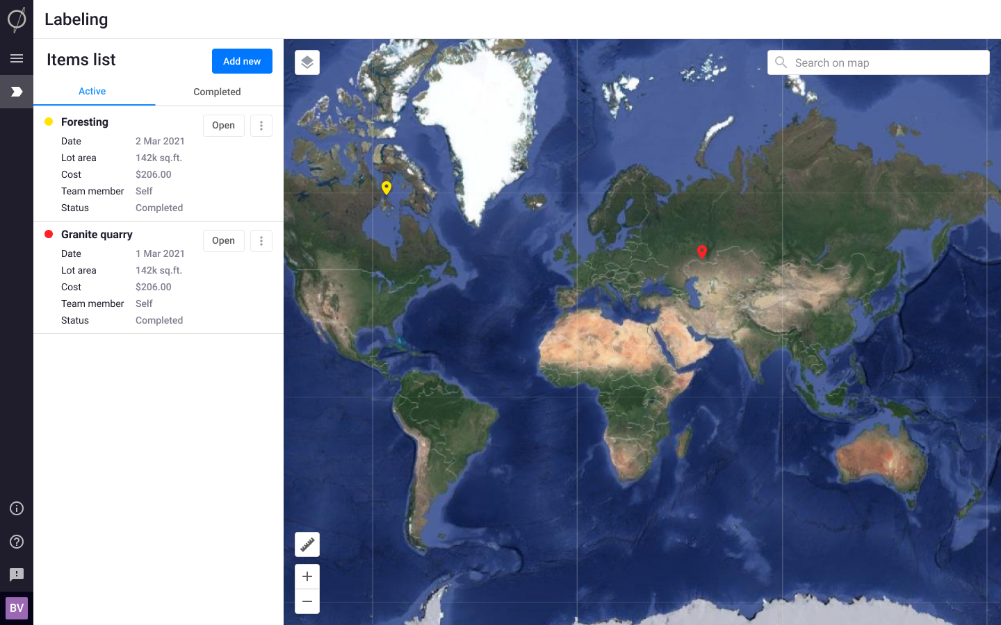
Analyzing Imagery is hard enough.
EarthAI simplifies the steps from pixels to insight.
Learn more about EarthAI: the Integrated GeoAI-Ops Platform
Discover, prepare, and analyze satellite imagery instantly:
- Global catalog of free, publicly available, and analytics-ready imagery
- Visual analysis tools to inspect and compare scenes
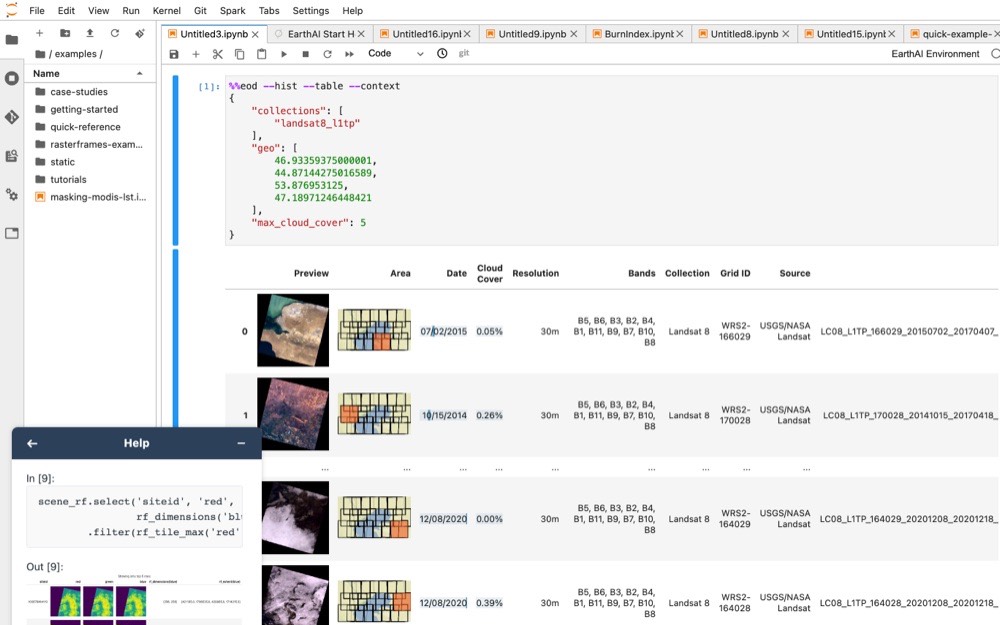
Analyze rasters in a DataFrame to enable:
- Geospatial queries
- Horizontally scalable raster processing
- Distributed machine learning via SparkML
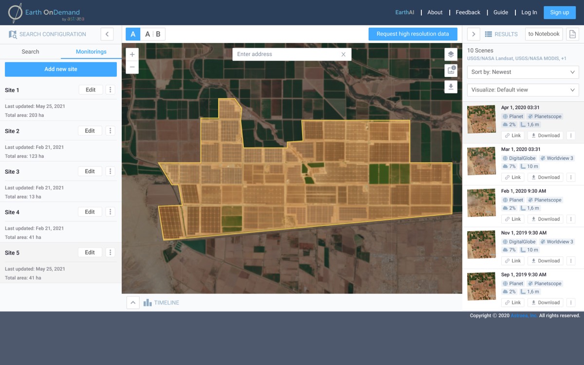
Build scalable analytics delivered through an accessible interface:
- Spatiotemporal queries
- Map algebra raster operations
- Spark ML algorithms
Automate analyses to reach a broader audience:
- No-to-low code environment
- Customizable tools
- Replicable models