EarthAI is an integrated imagery analysis platform designed to enable users to discover, access, and process Earth observation data.
- Discover where and when imagery intersects your area of interest with Earth OnDemand
- Build geospatial analytics with EarthAI Notebook, our hosted JupyterLab environment
- Scale your analytics with RasterFrames, our open source toolkit for geospatial cloud computing
- Automate delivery of custom analytics in EarthAI Workflow, our low/no-code geoprocessing engine
Earth OnDemand
Access and explore satellite imagery
Earth OnDemand's curated database of global analytics-ready imagery puts the power of geospatial data at your fingertips without the traditional challenges associated with big data ingestion and processing.
FREE access to public data
Get Started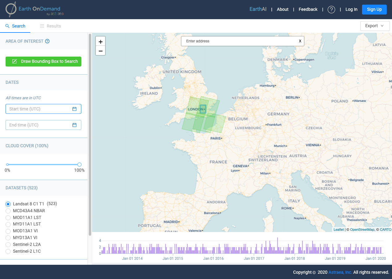
Features & Benefits
Data Discovery
Discovery imagery through an intuitive UI with faceted search capabilities
Pixel-agnostic
Our query engine indexes multiple public and private datasets, offering rapid exploration of over 8PB of imagery
Direct integration with analysis tools
Continue analysis in EarthAI Notebooks or your own analysis tools
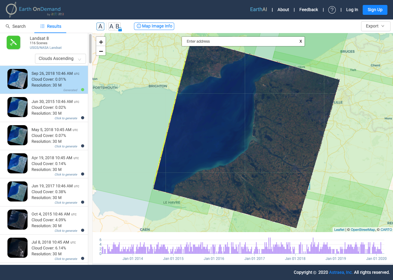
True color overview images
Download true-color imagery for your project. Coming soon... FULL RESOLUTION
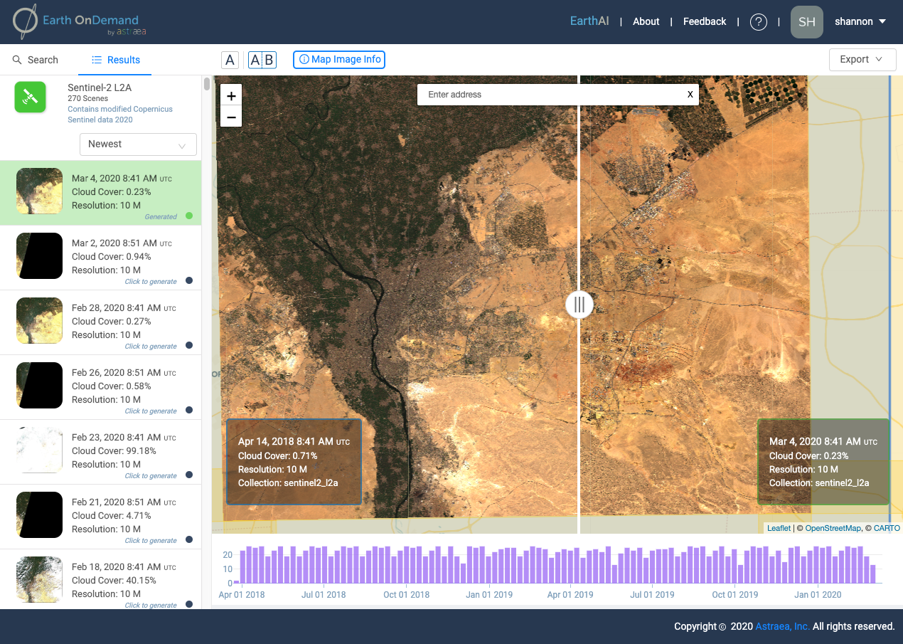
Side-by-side comparison
Earth OnDemand's side-by-side comparison tool allows visual analysis of change over time
Near-live data refresh
Earth OnDemand furnishes images as soon as they are available from the provider
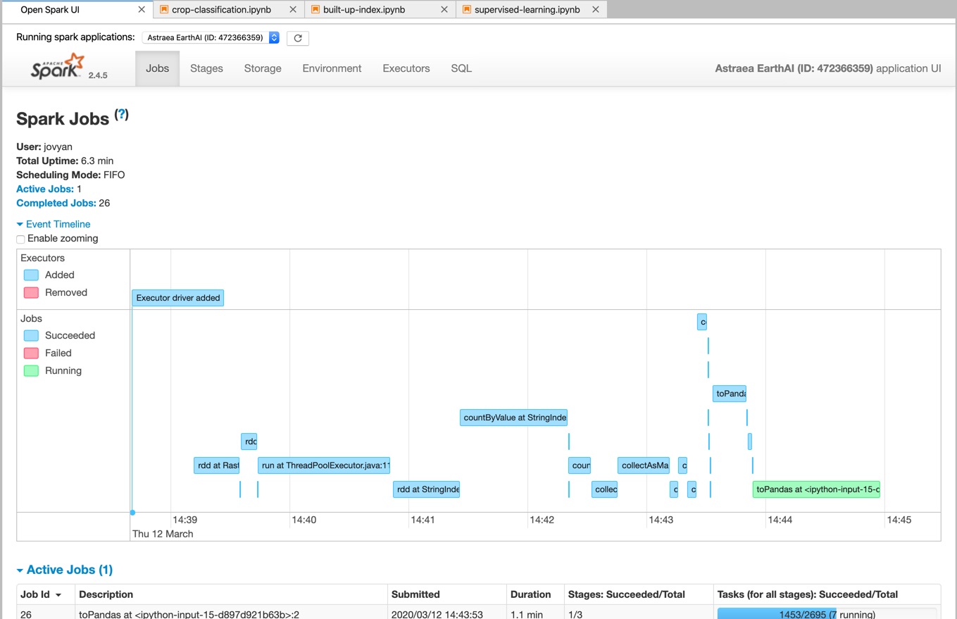
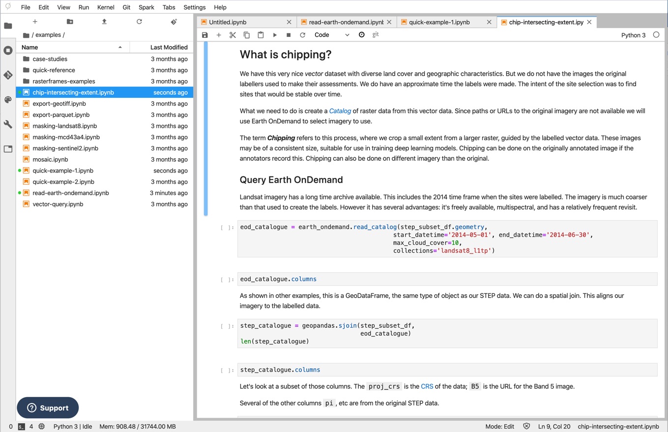
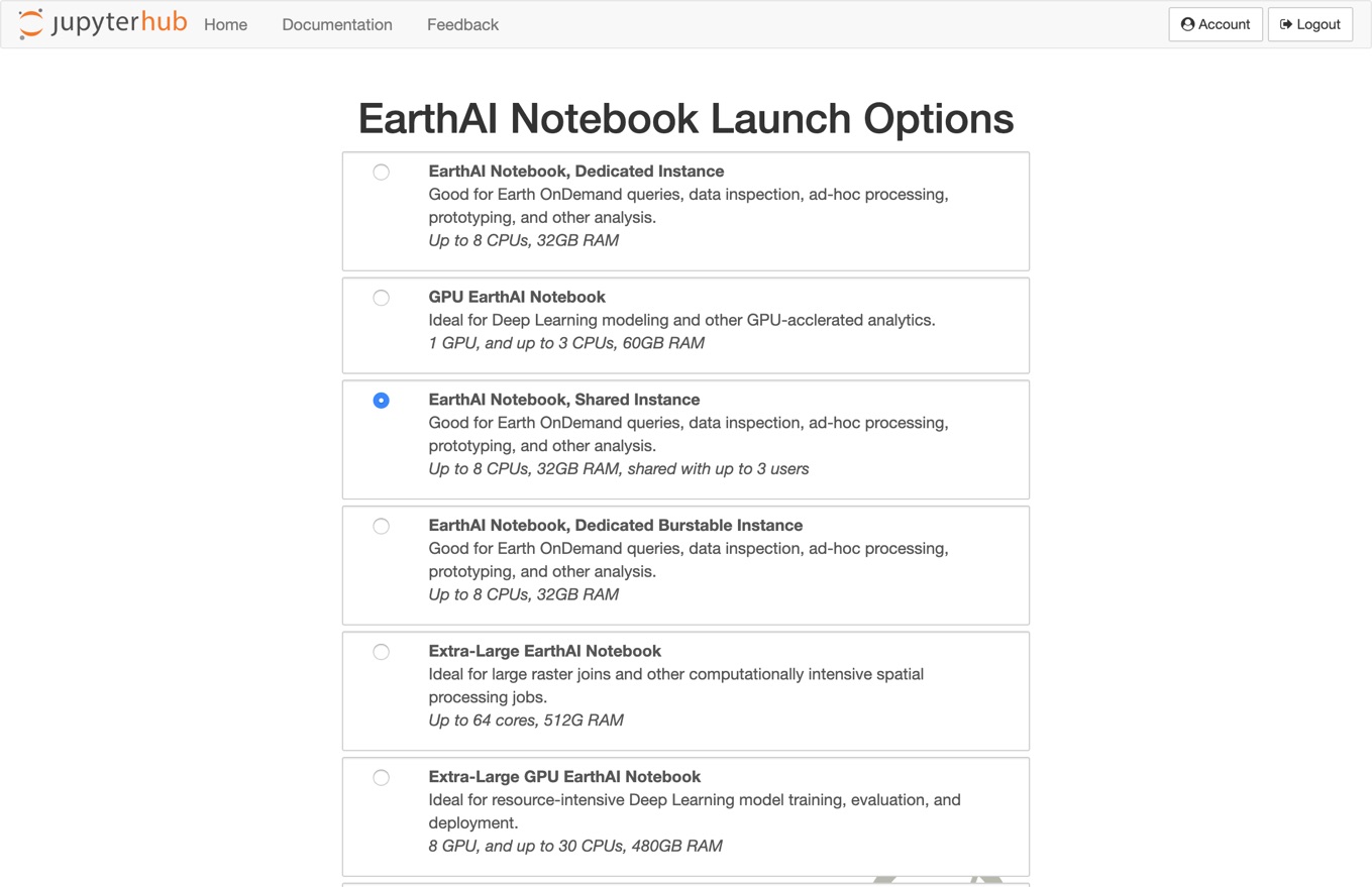
EarthAI Notebook
Analyze and scale geospatial analysis
Fully hosted and managed JupyterLab Notebooks designed specifically to analyze raster data.
Start your FREE trial
No CC required
Features & Benefits
API Access to Data
Access 8+ PB of free data via Earth OnDemand catalog
Friendly API designed by data scientists
Scalable
Fully managed scalable infrastructure
Easily switch between compute infrastructures to scale your analytics
Commercial Friendly
No restrictions on commercial use
Affordable plans
GPU Enabled
Accelerate your analytics or model training with GPU enabled computation
Cluster Compute
Scale your analytic on a fully managed Spark Cluster
Proprietary Libraries
Leverage proprietary raster processing libraries to enable your analytics
RasterFrames
Enabling global-scale machine learning
A free and open source toolkit allowing data scientists, analysts, and software developers to process and analyze geospatial-temporal raster data with the same flexibility and ease as any other data type in Spark DataFrames.
Get Started for FREE
Get Started!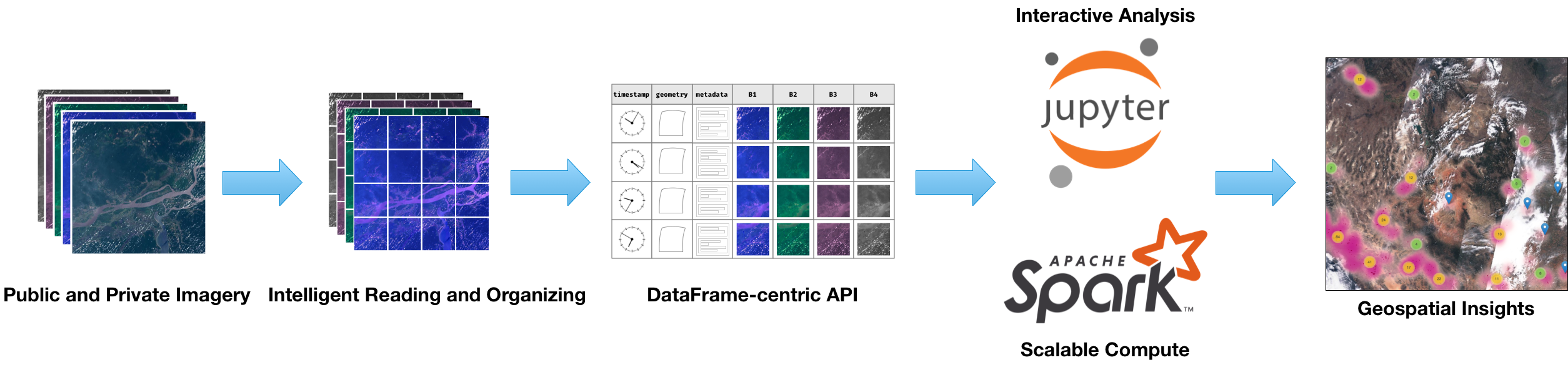
Features & Benefits
Open Source
As part of Eclipse Foundation LocationTech and released under the Apache 2.0 License, we are proud to support the global community of developers using RasterFrames to build unique Earth-observing data application
Multi-Language Support
Whether you prefer Python, SQL, or Scala, RasterFrames connects you to the extensive machine learning ecosystem of Apache Spark
Data Frames
RasterFrames transforms EO raster and vector data into the tabular rows-and-columns structure that humans favor for analysis
Scalable Foundation
From laptops to super computers, RasterFrames scales your solution to available hardware, locally or in the cloud
Enables Machine Learning
AI models generally like tabular data. By generating DataFrames from raster data, RasterFrames enables data science practitioners to extract insights from this data
Community of Practice
As part of a diverse and growing user base, RasterFrames users can connect with like-minded practitioners around the world
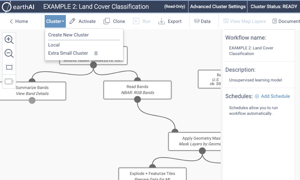
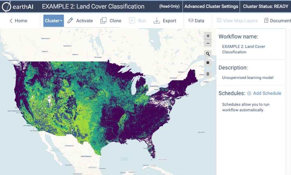
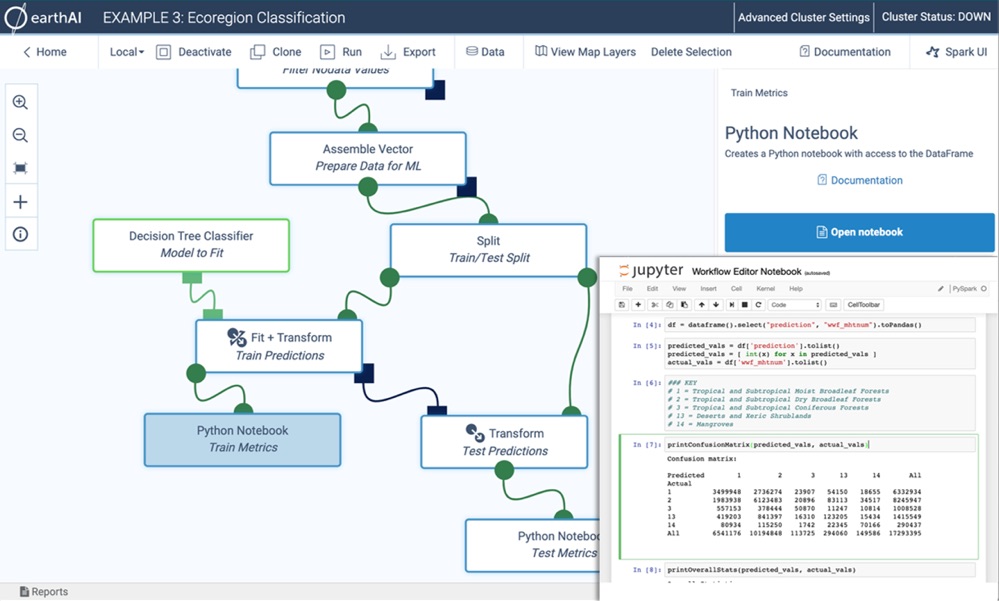
EarthAI Workflow
Access and explore satellite imagery
EarthAI Workflow is the first integrated artificial intelligence platform for big geospatial data, enabling global scale machine learning with analytics-ready Earth-observing satellite imagery. Turn pixels into insight with ease using Astraea EarthAI's visual programming interface, push-button supercomputing, and built-in deployment engine.
Features & Benefits
EO meets AI
Our full stack of cloud-native software enables you to apply advanced machine learning algorithms to EO data at scale
Elastic Compute
Designed for scalability from the beginning, our platform scales seamlessly so you can think more about insights than Dev Ops
Access for All
The EarthAI toolchain offers multiple entry points, enabling access to EO data for everyone, regardless of previous experience
Community of Practice
Our platform helps connect you with others interested in similar problems, facilitating the sharing of datasets and algorithms
Work on your terms
We offer both a non-code-based visual interface and pre-built workflows, as well as customizable Jupyter notebook environment
Insights at Scale
Converging computer vision algorithms with scalable compute is unlocking the insights that this massive data holds about our planet